Google Maps discovers the Brazilian islands
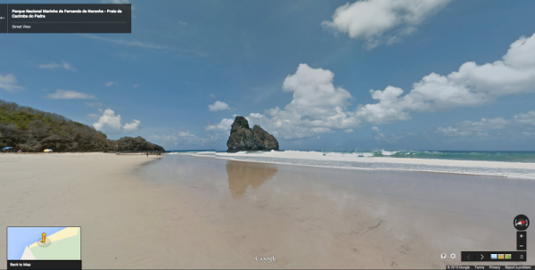
The Google Maps team is at it again, trekking the world to bring images to its users, going around cities, down trails and into the oceans. This time the target is the islands of Brazil, which are seldom seen, even by tourists. These are the dots of land known as Fernando de Noronha and Atol das Rocas, which lay just off the coast. According to Wikipedia, they are "an archipelago of 21 islands and islets in the Atlantic Ocean, 354 km (220 mi) offshore from the Brazilian coast".
This is more than just beautiful tropical island landscapes, the Google crew also went beneath the waves for more images. You'll get to see the dolphins swim and even a grab a rare glimpse of sea turtles in their natural environment.
"This Street View journey not only takes you across golden beaches and around towering cliffs, but also deep into the ocean for Brazil’s first underwater Street View collection" according to Deanna Yick, Street View Program Manager for Google.
Both areas are stunning in their tropical beauty and are seldom seen by tourists to the area, but more importantly "Fernando de Noronha and Atol das Rocas are also sanctuaries for animals and marine wildlife precious to the regions, including dolphins, turtles, and a variety of fish". That's becoming increasingly important in today's age of extinctions. So kick back and enjoy your tour.