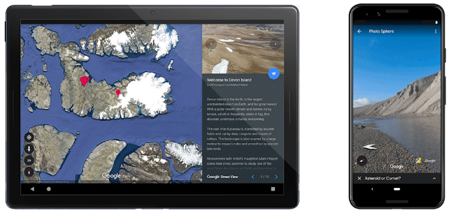
Google Street View takes you to Devon Island, which isn't on Mars

Ever hear of Devon Island? Yeah, neither have I. Apparently, it is an island in Canada that is referred to as "Mars on Earth" by some, including Google. Why? Because of its similar terrain/environment to the "red planet."
You see, the search giant seems very excited about bringing its popular Google Street view to this location. Truth be told, at first, I thought Google actually had miraculously brought Street View to the actual planet of Mars (silly me), but upon further investigation, my excitement was quickly extinguished when I discovered it was just a place here on Earth. But OK, I guess it's still kind of cool.
ALSO READ: Google Maps for Android and iPhone gets Lime integration
"Devon Island, a desolate land mass in Canada’s Arctic with a polar climate and treacherous terrain, is the largest uninhabited island on Earth. Yet the factors that make the island unlivable also make it indispensable to the scientists and researchers who work there -- its climate and landscape are the closest thing to Mars that can be found on Earth," says Katja Minitsenka, Program Manager, Google.
ALSO READ: Google Maps for Apple iPhone and iPad now lets you follow your favorite places
Minitsenka further says, "Now anyone can visit 'Mars on Earth' in Street View. Last year, I received a special invite from Dr. Pascal Lee, chairman of the Mars Institute and director of the Haughton-Mars Project, to visit Devon Island and learn about the research done there. We spent three months preparing for the expedition, and after 72 hours on seven flights, found ourselves at basecamp surrounded by an untouched landscape."
If you want to check out Devon Island on Google Earth, you can do so here. This includes a "guided tour" where you can easily access significant landmarks -- if you don't want to just scroll around aimlessly.
