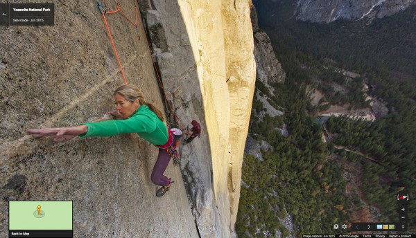
Google Street view takes you to the heights of El Capitan's rock wall

If you've ever rock climbed then chances are you know El Capitan. It is the quintessential big wall -- the icon of the sport. Every climber aspires to one day visit Yosemite and tackle the multi-pitch ascent. There are lots of 5.14 climbs around, but there is something about the allure of a big wall.
Can't make it to California? You aren't alone, there are too many locations for any climber to get to in a lifetime. However, Yosemite is the icon, the Smith Rocks of big walls. You can speed climb it or use a hanging bivouac (don't roll over in the night).
For those who don't see a trip to California in the cards, there's always Google Street view. The intrepid team has tackled the heights of the cliff face for you, taking you up what may be considered both exciting and scary.
"Maybe it was the sheer exhaustion from being in the middle of a 19-day climb of the Dawn Wall, but when the guys at Google Maps and Yosemite National Park asked if I wanted to help them with their first-ever vertical Street View collection of El Capitan in Yosemite, I didn’t hesitate. Yosemite has been such an important part of my life that telling the story of El Capitan through Street View was right up my alley—especially when it meant working with the Google engineers to figure out some absurd challenges" says Tommy Caldwell of Google.
19 days is a lot of time to spend on one climb. Other routes can be done much faster, but Google spent the time to do one of the tougher ascents. It's well worth checking out, but put your fear of heights aside.
