Google Earth and Maps get sharper satellite imagery
When Google Earth was first released, it was life-changing. While people take it for granted now, seeing aerial views of the entire planet -- including something as mundane as your neighbor's roof -- was something many folks never thought possible. This satellite imagery is now used in other mapping solutions, such as the ubiquitous Google Maps, giving us the ability to see the world from the comfort of our homes.
Google's satellite imagery looks great, but as those in the tech world know, there is no such thing as "good enough". Better is always just around the corner, and today, the search giant announces that its imagery has been improved.
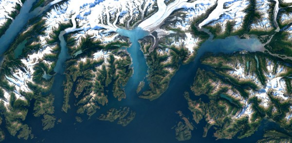
"Landsat 8, which launched into orbit in 2013, is the newest sensor in the USGS/NASA Landsat Program -- superior to its predecessors in many ways. Landsat 8 captures images with greater detail, truer colors, and at an unprecedented frequency -- capturing twice as many images as Landsat 7 does every day. This new rendition of Earth uses the most recent data available -- mostly from Landsat 8 -- making it our freshest global mosaic to date", says Chris Herwig, Program Manager, Google Earth Engine.
Herwig further says, "to produce this new imagery, we used the same publicly available Earth Engine APIs that scientists use to do things like track global tree cover, loss, and gain; predict Malaria outbreaks; and map global surface water over a 30 year period. Like our previous mosaic, we mined data from nearly a petabyte of Landsat imager -- that’s more than 700 trillion individual pixels -- to choose the best cloud-free pixels. To put that in perspective, 700 trillion pixels is 7,000 times more pixels than the estimated number of stars in the Milky Way Galaxy, or 70 times more pixels than the estimated number of galaxies in the Universe".
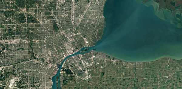
Holy cow, y'all. This enhanced imagery is quite the accomplishment. True, we cannot yet zoom in on a blade of grass or colony of ants, but Google is contributing to the overall betterment of man and science. By pushing boundaries, the search giant can deliver improved mapping solutions, such as Google Maps and Earth.
If you want to check it out, the newly enhanced imagery is available now in Google's products. You can begin using it immediately.