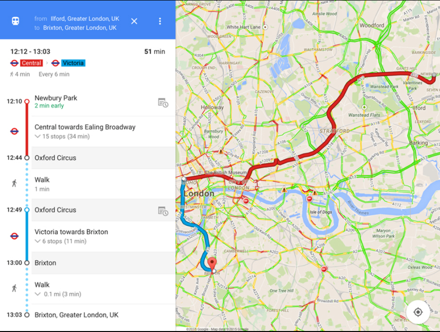
Google Maps for iOS adds full-screen maps, color-coded transit links

Google has released Google Maps for iOS 4.4, a new version of its map app for iPhone and iPad users.
The new build promises one-tap access to a full-screen map, the ability to view transit colors when viewing public transport directions and the ability to filter search results for Zagat-rated restaurants.
The main new feature in version 4.4 is the ability to view a map shorn of all distractions, including boxes, buttons and pins. Users should simply tap an empty spot on the map once to see what gets hidden -- tap again to hide more. Once all extra detail has been hidden, tap again to bring it back.
Users also gain more clear instructions when asking for directions using supported public transport links -- now separate transit lines are color-coded to match the colors used by the transport authority in question.
Users can now quickly get directions to a place by saying or typing "directions to" before entering the desired destination.
One final tweak allows users in applicable locations to filter search results so only restaurants rated by the Zagat website are shown.
The update is rounded off by the usual bug fixes. Google Maps for iOS 4.4.0 is available now for iPads, iPhones and iPod touches running iOS 7.0 or later.