
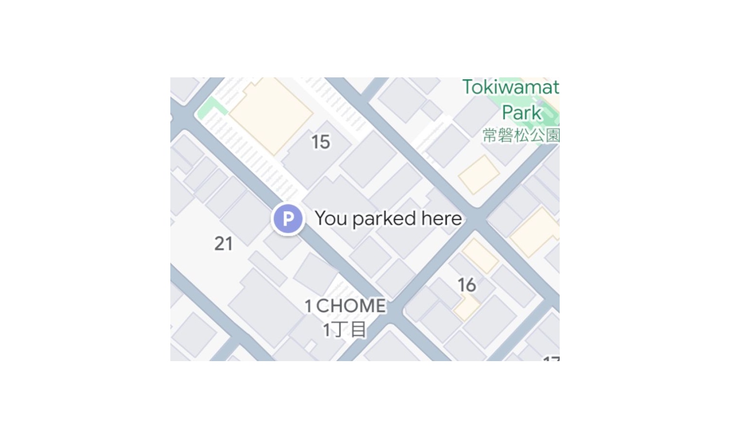
Google Maps now makes it easier for iPhone users to find their cars
Google has launched a new feature for iPhone users that could make owners of Android handsets a little envious. Anyone who has parked their car in an unfamiliar town or in a particularly gigantic parking lot will have experienced the panic of not being able to locate their vehicle – Google Maps is now on hand to help.
iPhone owners using Google Maps – yes, this breed of person does exist – can now have their parking location saved automatically. This is an upgrade of what is available to Android users at the moment.
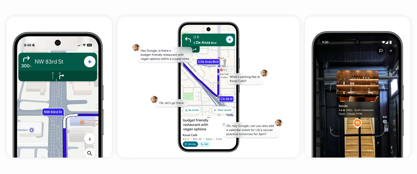
Google Maps to receive AI upgrade powered by Gemini
Google Maps is to receive an AI upgrade powered by the tech giant’s Gemini. This will add a conversational, hands-free experience to the app that is intended to make navigation smarter and less distracting.
It represents yet another step in Google’s ongoing integration of the generative model into its most widely used products. The firm added AI smarts to Google Earth not so long ago.
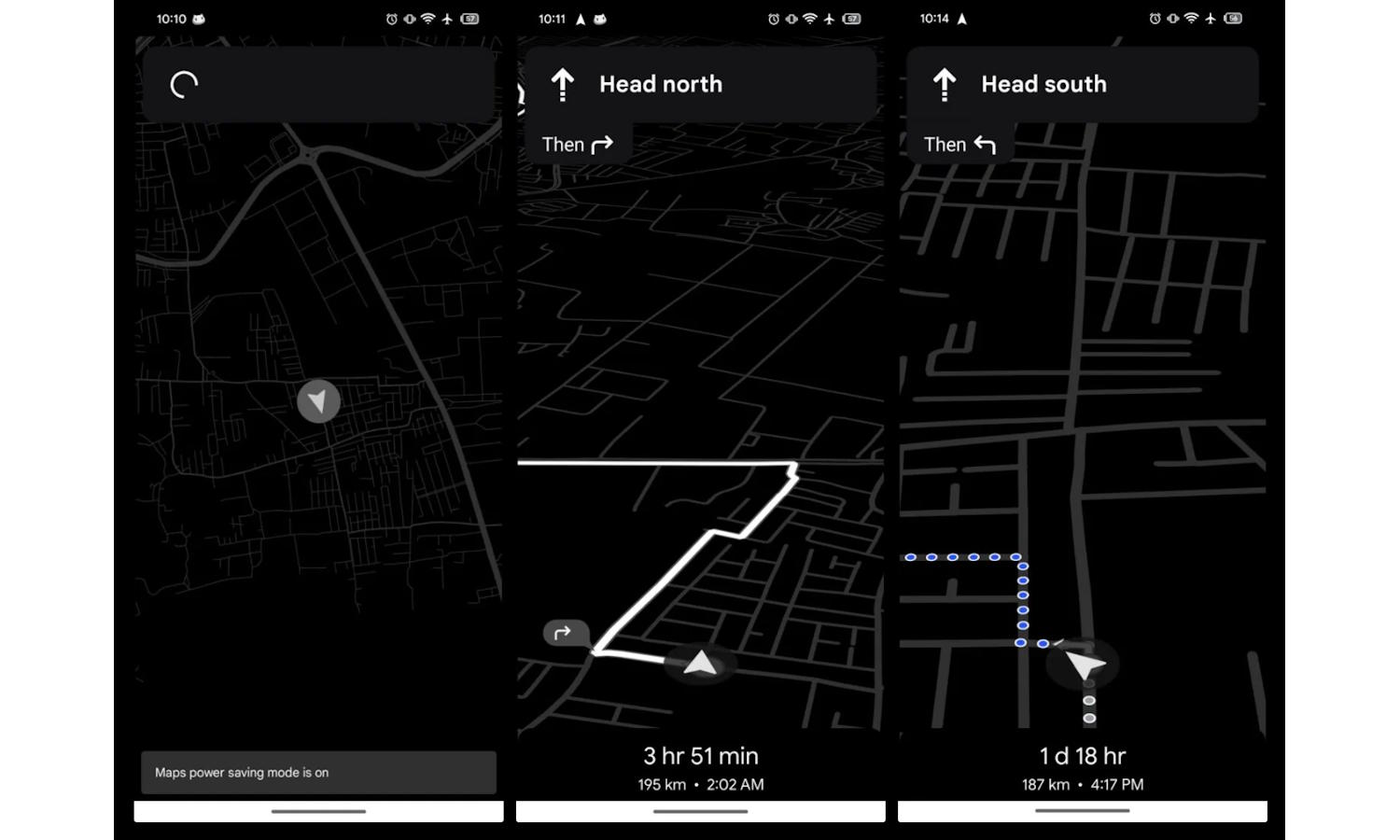
Google Maps could soon have a helpful power-saving mode
Millions of us rely on Google Maps to get us from A to B; it would be fair to call it an indispensable tool for its users. If you have ever turned to the navigation app, you will almost certainly have noticed that it is something of a battery killer.
Now Google is looking to do something about this, according to a new report. A new power-saving mode is in the works that will maximize battery life when navigating. Why is the change so important, though?
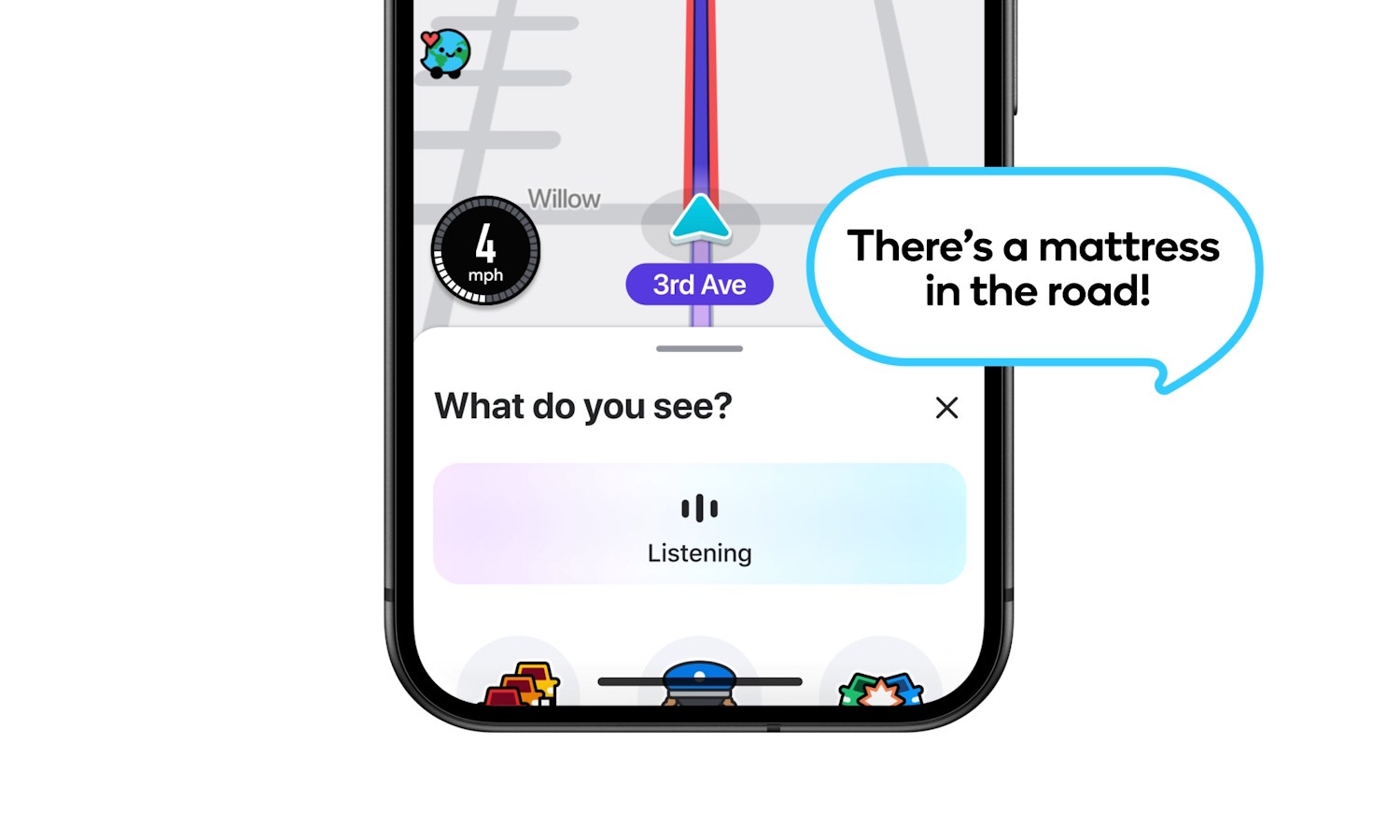
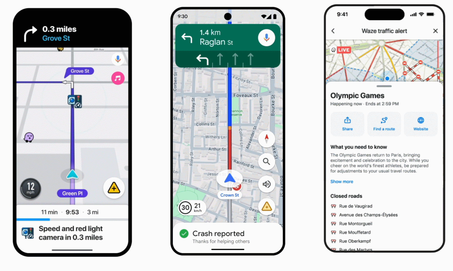
Waze is rolling out voice-controlled Conversational Reporting of hazards
Navigation tools such as Waze and Google Maps not only help you find a route from A to B, but also provide information about road closure, vehicle breakdowns, police in the area, and hazards on the road. With this last item being reliant on reports from road users, Waze has been investigating ways to make do so easier.
When you spot a hazard on the road and want to warn others, you have had to wait until you are able to stop to do so (safely, at least). Now Waze is rolling out a feature called Conversational Reporting which lets you use your voice – and a dash of AI – to let other road users know about what you have spotted.
Google Maps in Android 16 is getting an amazing Live Updates feature
For many people, Google Maps is absolutely indispensable, and Google is about to make the navigation tool even more useful in Android 16. Taking advantage of a new feature introduced in the latest version of its mobile operating system, Google Maps is gaining useful Live Updates support.
Live Updates are a new type of notification that are used in very specific circumstances – such as flight tracking, delivery tracking, or navigation. Google is experimenting with Google Maps integration and, if it is done correctly, it could be a game-changer.
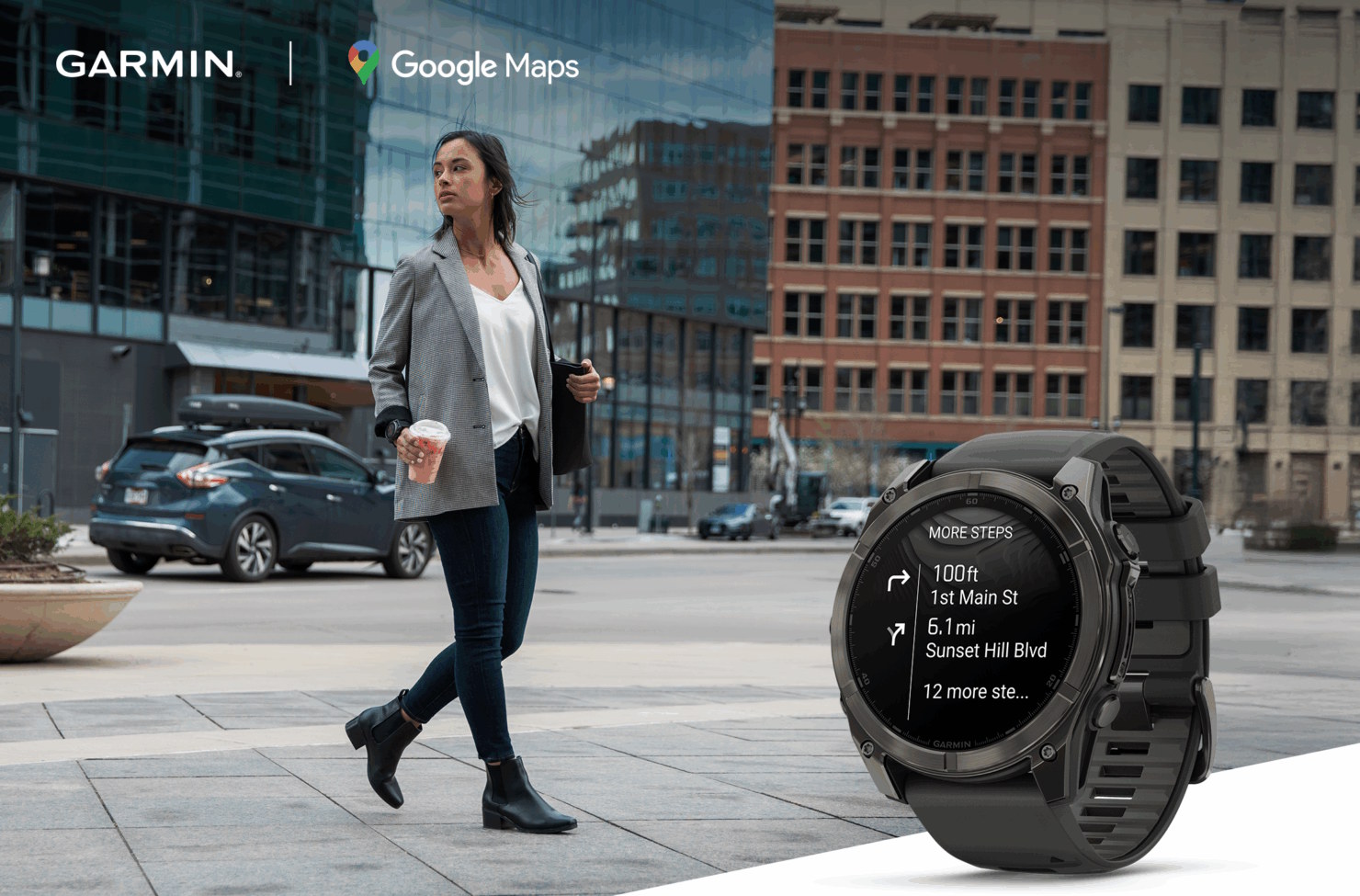
Google Maps finally lands on Garmin devices for on-wrist navigation
Google Maps is so ubiquitous that it is hard to imagine that there are any unsupported platforms remaining, but there are still a few. This is highlighted by arrival of Google Maps for Garmin smartwatches via the Connect IQ Store.
This free app means that owners of key Garmin devices can now benefit from turn-by-turn navigation on their wrist. The newly released app is targeted primarily at walkers, cyclists and runners, but it can also be used when driving or performing other activities if this feels helpful to users.
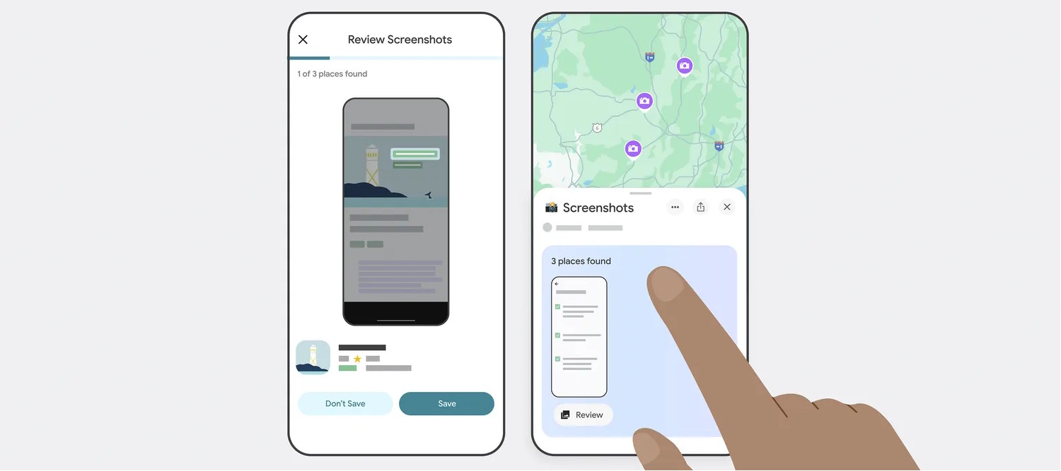
Google Maps can now use your screenshots to help you plan trips thanks to Gemini AI
Screenshotting stuff can seem like a great way to remember something for later, but captures soon get lost and forgotten. Google is looking to change this by bringing new Gemini-powered features to Google Maps.
The company thinks that it can help you to make sense of the “travel blogs, news articles or social media posts” you’ve screengrabbed while researching a trip. Turning to AI to make sense of a heap of images is Google’s solution. Here’s how it can help you.
Google admits accidentally deleting Timeline data of Google Maps users due to a ‘technical issue’
Users of Google Maps have been complaining in growing numbers that their Timeline data has mysteriously vanished. Now Google has confirmed that this was down to a “technical issue” rather than user error, and warned that there will be no way to recover this data for some people.
The Timeline feature of Google Maps stores location history, and is used by many people as a way of keeping track of places they have visited. Now, for those who were unaware of a recent change to the way Timeline data is stored, the technical SNAFU means that these memories are lost forever.
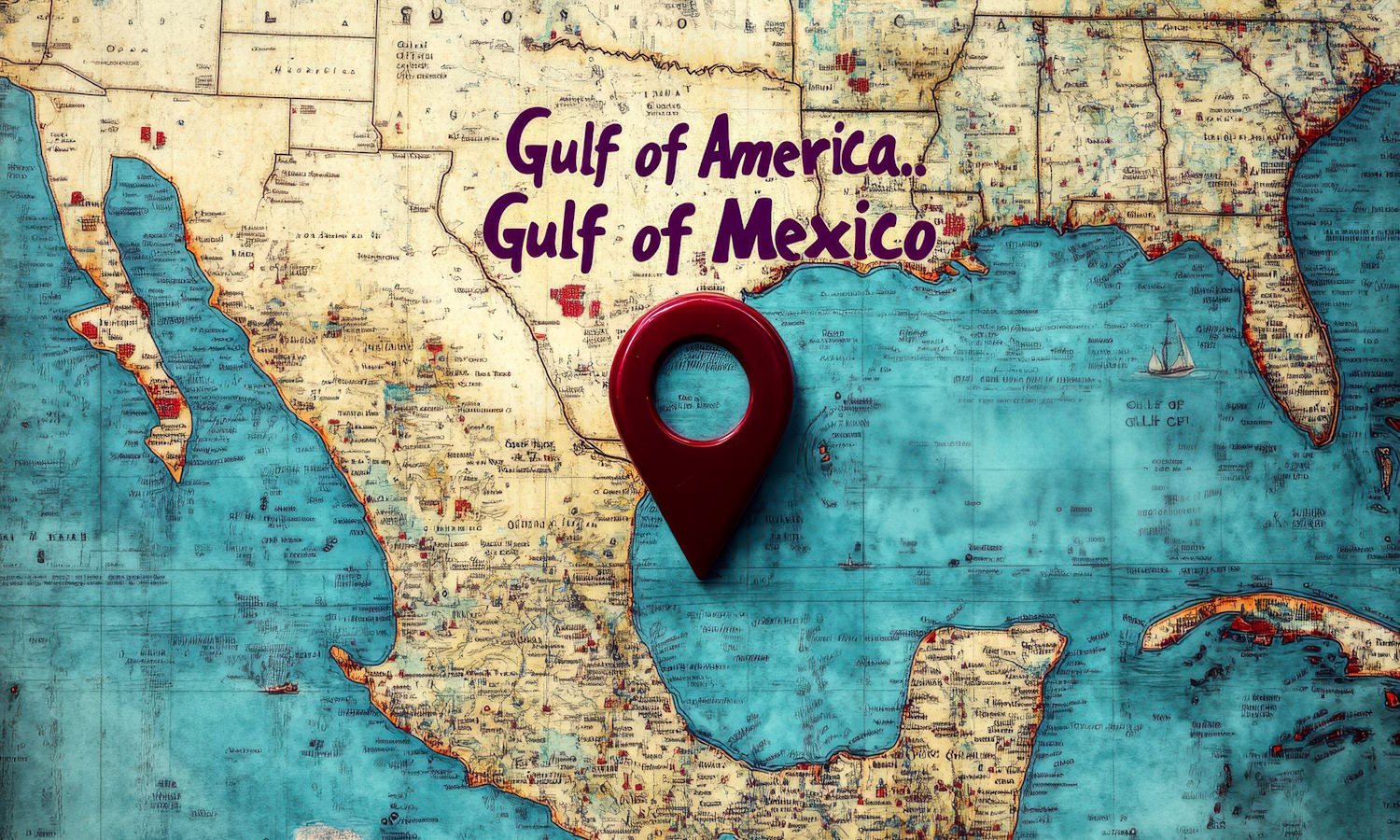
Apple is renaming the Gulf of Mexico in Apple Maps… and is going further than Google
Shortly after Google Maps changed the name of the Gulf of Mexico to the Gulf of America, Apple Maps is starting to do the same.
When Google rolled out the name change at the weekend, the company took a three-pronged approach which means three different naming conventions are used in different parts of the world. Having started to implement the name change itself, Apple is showing that it is willing to do more than Google by making the change global.
Google Maps now has multiple ways of referring to the Gulf of Mexico
Within moments of being inaugurated as US President earlier this year, Donald Trump vowed to rename the Gulf of Mexico. Sure enough, an executive order followed, changing the name to the Gulf of America -- but there has been the question about how most of the world will refer to it moving forward.
On a day-to-day basis, there will be some who use the new name, some who stick with the previous one -- but what about map services? Google previously stated that when the Geographic Names Information System was updated, Google Maps would reflect the new nomenclature. Now the name change has been implemented, but what you see will depend on where you are in the world.

Google Maps will honor President Trump’s renaming of the Gulf of Mexico to the Gulf of America and Denali to Mount McKinley
One of Donald Trump’s first pledges after being sworn in as the 47th president of the USA was to rename both the Gulf of Mexico and Denali. This was very quickly acted upon when he signed a slew of executive orders -- something the White House described as “honoring American greatness”.
Seen variously as controversial, symbolic, patriotic, confrontational and more, the changes of the names have sparked global debate. One question that has been raised a lot over the last week has been whether the likes of Apple Maps and Google Maps will implement the changes as well -- although not globally.
Google Maps makes it easier to report cops on the road
Google has announced a series of updates for both Maps and Waze which will help to keep drivers better informed on their journeys. One of the most pleasing updates for Google Maps is an easier way to report when you've seen cops in the area so other drivers can be alerted -- and you can benefit from other drivers' reports.
Another helpful addition to Maps means that when you navigate to an address, the building you are looking for and, importantly, the entrance, will be highlighted for you. New features and options are not limited to Google Maps; Waze also has a number of handy additions.
Google could delete your Google Maps Timeline data in the name of privacy, so take action now
For nostalgia heads, the Timeline feature of Google Maps is an enjoyable way to peek into the past. Previously known as Location History, Timeline works much like Facebook Memories, helping jog your memory about trips you've taken and places you've visited.
But there are big changes afoot. Google is moving away from storing location data in the cloud to storing it on mobile devices instead. While this is a privacy-boosting move, Google says that the change means that users could find their Timeline data is deleted unless they take action.

Google Street View arrives in Kazakhstan
Starting today, the captivating landscapes and vibrant cities of Kazakhstan are just a click away, thanks to the addition of the Central Asian nation to Google Street View. Now, users can traverse the snow-capped mountains, the shores of the Caspian Sea, and the futuristic skyline of Astana from the comfort of their own homes.
Street View, available in over 100 countries, has become an indispensable tool for exploring vacation destinations, checking out new neighborhoods, or finding the best parking near favorite eateries. With its rich cultural heritage, Kazakhstan’s inclusion in Street View opens up a new avenue for tourists to dive into the region’s architectural history and contemporary offerings.
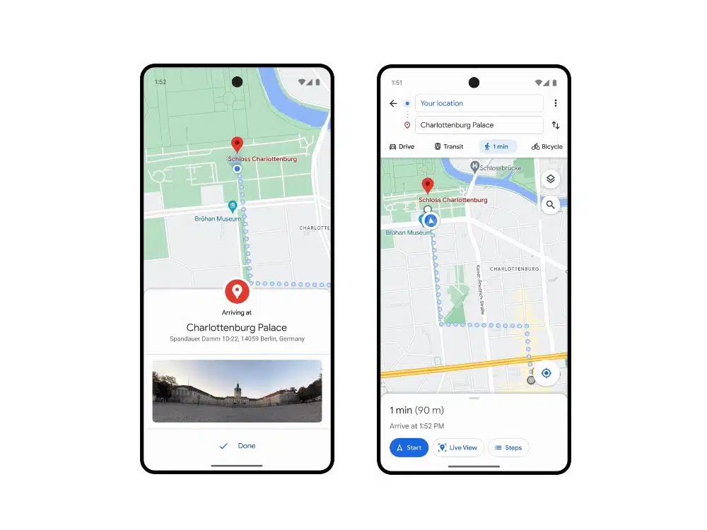
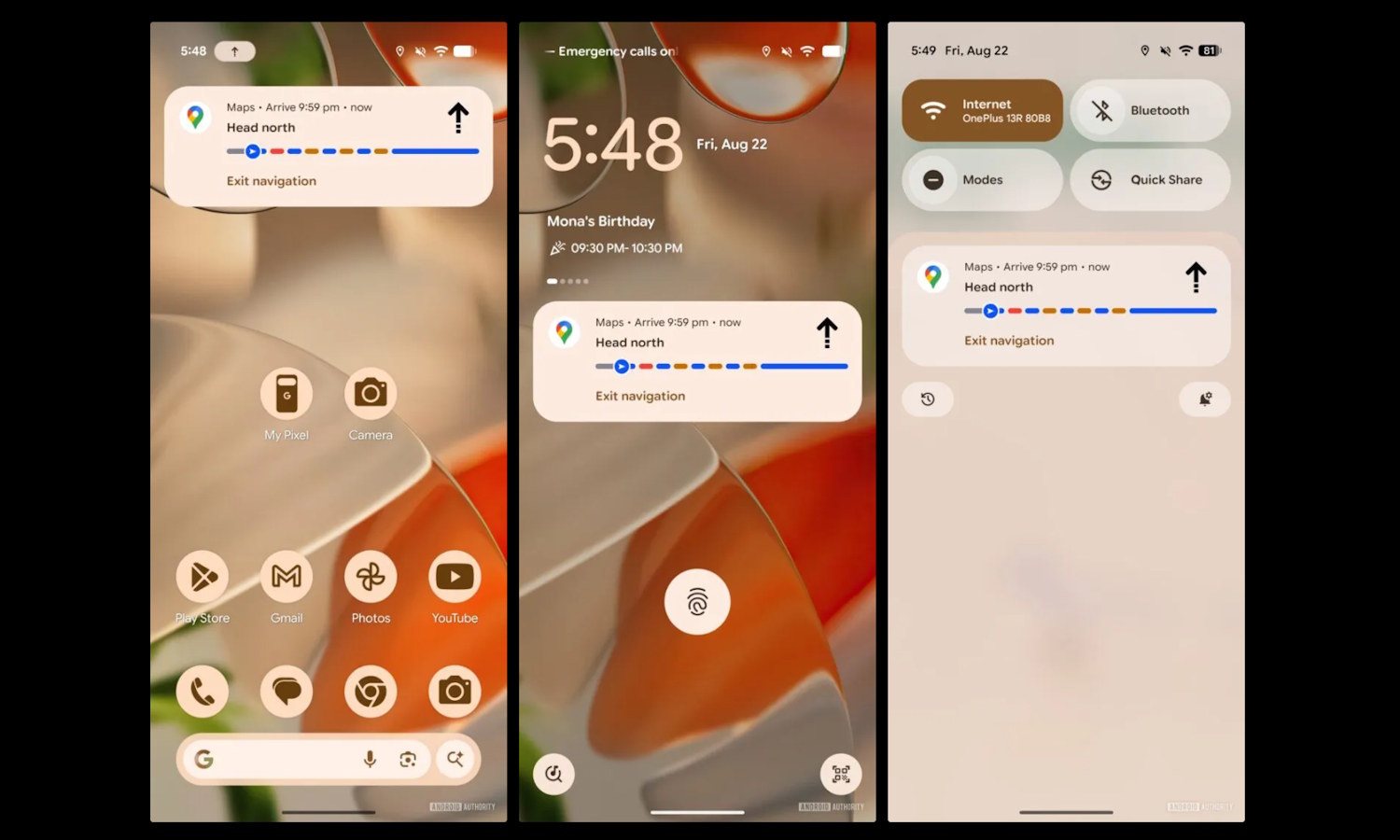
Google finally brings glanceable directions to Google Maps a year after announcing the feature
This time last year, Google announced a series of new features for Google Maps which it said would be rolling out in the months that followed. While most saw the light of day, others started to feel like vaporware -- notably, the intriguing "glanceable directions".
A full 12 months on, the glanceable directions feature is finally being made available to iOS and Android users. It shows directions on the lock screen of a handset, so there's no need to constantly unlock the device for updates.